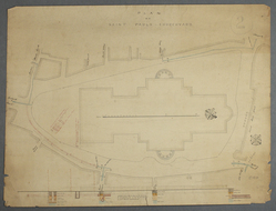
- TítuloPlan of Saint Paul's churchyard
- ReferenciaSPCAA/D/1/10/1
- Fechac.1843-1857
- Creador
- Descripción físicaPlan of St Paul's churchyard, executed on paper in red and black, and watercolour (various colours).
- DescripciónPlan (with scale) of the churchyard showing the cathedral and sites where pits were dug in 1843. There is also a substratum section showing the soil types to the south of the cathedral, with boring hole locations.
- Condiciones de accesoAccess is strictly by appointment only with the architectural archivist. Material dating from 1990 to the present day is not currently available for public consultation. Some records are subject to a closure period of 75 years under the Data Protection Act.
- Nivel de descripción
Navegador jerarquico


